

Proclamation under the Nature Conservation Act 2002
I, the Governor in and over the State of Tasmania and its Dependencies in the Commonwealth of Australia, acting with the advice of the Executive Council, by this my proclamation made under section 17(1) of the Nature Conservation Act 2002 declare –
14 December 2009(a) the reserved land specified in Part 1 of Schedule 1 to this proclamation, being areas of land at Mole Creek reserved in the class of conservation area*, to be reserved land in the class of national park and give the name Mole Creek Karst National Park to that reserved land; and(b) the reserved land specified in Part 2 of Schedule 1 to this proclamation, being an area of land at Caveside reserved in the class of conservation area*, to be reserved land in the class of national park and give the name Mole Creek Karst National Park to that reserved land; and(c) the reserved land specified in items 1 and 2 of Part 3 of Schedule 1 to this proclamation, being areas of land at Mayberry reserved in the class of conservation area*, to be reserved land in the class of national park and give the name Mole Creek Karst National Park to that reserved land; and(d) that this proclamation takes effect on the day on which its making is notified in the Gazette.
*Note: The areas of land at Mole Creek, Caveside and Mayberry were each acquired by the Governor in 2008 for a conservation purpose within the meaning of the Nature Conservation Act 2002. The titles to the areas of land were subsequently registered in the name of the Crown and those areas of land became conservation areas by virtue of section 14(2)(b) of that Act.
PETER G. UNDERWOOD
Governor
By His Excellency's Command,
D. E. LLEWELLYN
Minister for Primary Industries and Water
SCHEDULE 1 - Areas of land
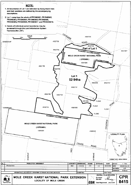
PART 1 - Mole CreekAll those areas of land comprising about 52.94 hectares, shown as Lot 1 and bounded by heavy black lines on Plan 8415 in the Central Plan Register, a reduced copy of which is set out, by way of illustration only, in Part 1 of Schedule 2 to this proclamation.
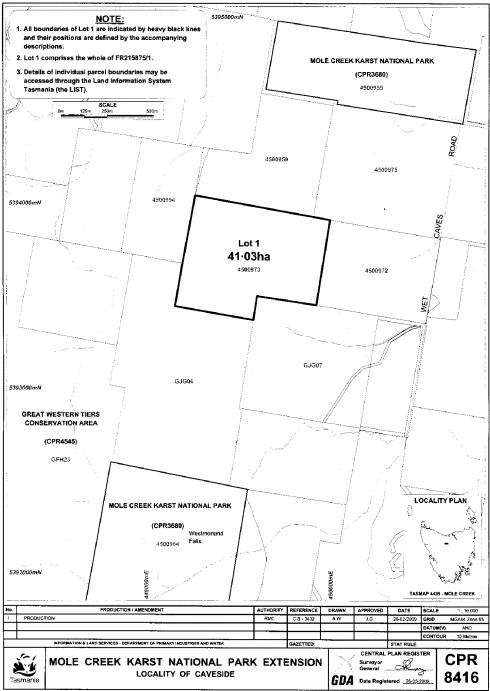
PART 2 - CavesideAll that area of land comprising about 41.03 hectares, shown as Lot 1 and bounded by a heavy black line on Plan 8416 in the Central Plan Register, a reduced copy of which is set out, by way of illustration only, in Part 2 of Schedule 2 to this proclamation.
PART 3 - Mayberry
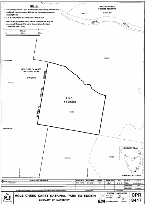
1. All that area of land comprising about 17.80 hectares, shown as Lot 1 and bounded by a heavy black line on Plan 8417 in the Central Plan Register, a reduced copy of which is set out, by way of illustration only, in Part 3 of Schedule 2 to this proclamation.
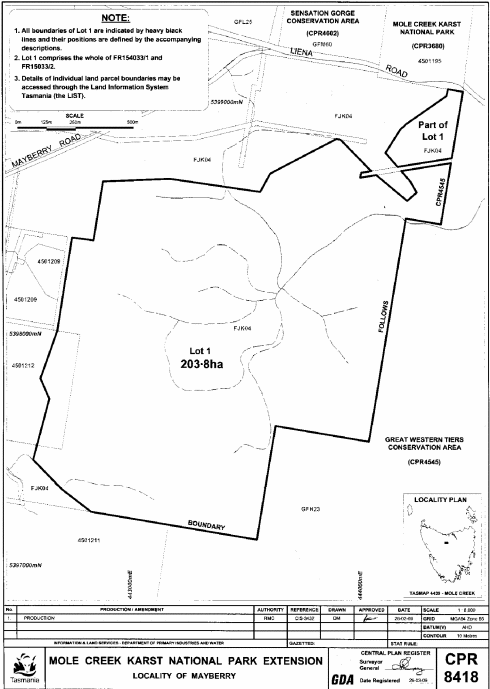
2. All those areas of land comprising about 203.8 hectares, shown as Lot 1 and bounded by heavy black lines on Plan 8418 in the Central Plan Register, a reduced copy of which is set out, by way of illustration only, in Part 4 of Schedule 2 to this proclamation.
SCHEDULE 2 - Plans
PART 1 - Mole Creek (Plan 8415)
PART 2 - Caveside (Plan 8416)
PART 3 - Mayberry (Plan 8417)
PART 4 - Mayberry (Plan 8418)
Displayed and numbered in accordance with the Rules Publication Act 1953.
Notified in the Gazette on 23 December 2009
This proclamation is administered in the Department of Primary Industries, Parks, Water and Environment.