

Proclamation under the National Parks and Wildlife Act 1970
I, the Governor in and over the State of Tasmania and its Dependencies in the Commonwealth of Australia, acting with the advice of the Executive Council, on the recommendation of the Minister and with the approval of each House of Parliament, by this my proclamation made under section 14(1) of the National Parks and Wildlife Act 1970 declare –
4 December 2000(a) the Crown land specified in Part 1 of Schedule 1 to this proclamation to be reserved land in the class of historic site and give the name Low Head Historic Site to that land; and(b) the Crown land specified in Part 2 of Schedule 1 to this proclamation to be reserved land in the class of historic site and give the name Cape Sorell Historic Site to that land; and(c) the Crown land specified in Part 3 of Schedule 1 to this proclamation to be reserved land in the class of State reserve and give the name Mersey Bluff State Reserve to that land; and(d) the Crown land specified in Part 4 of Schedule 1 to this proclamation to be reserved land in the class of State reserve and give the name Table Cape State Reserve to that land; and(e) the Crown land specified in Part 5 of Schedule 1 to this proclamation to be reserved land in the class of State reserve and give the name Cape Wickham State Reserve to that land; and(f) that this proclamation takes effect on the day on which its making is notified in the Gazette.
G. S. M. GREEN
Governor
By His Excellency's Command,
D. E. LLEWELLYN
Minister for Primary Industries, Water and Environment
SCHEDULE 1 - Areas of land
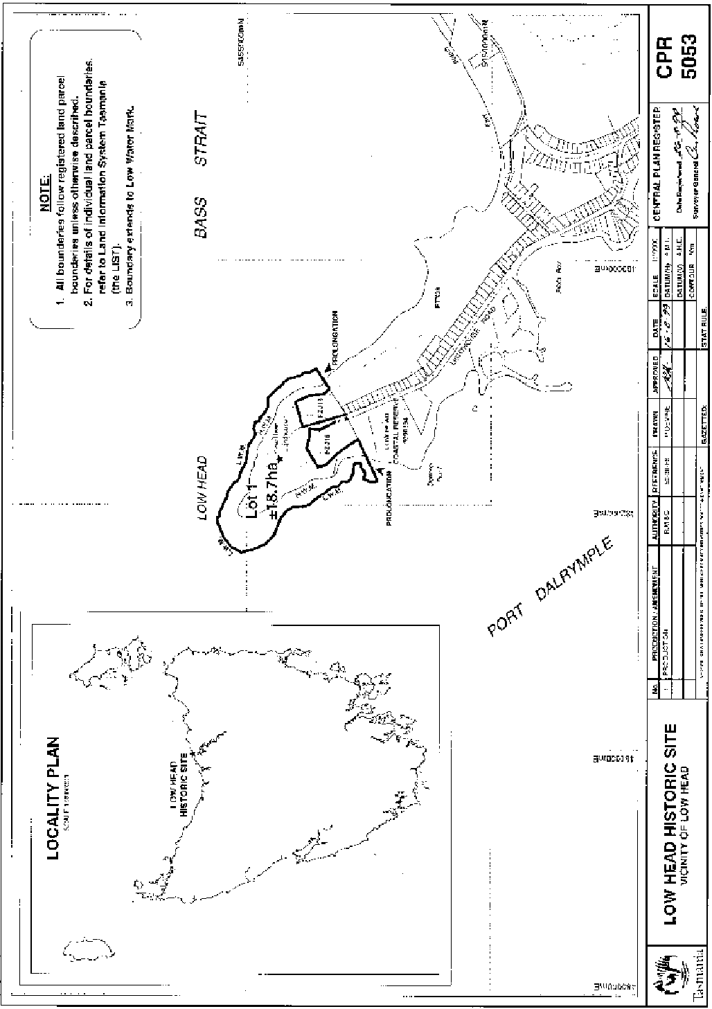
PART 1 - Low Head Historic SiteAll that area of land comprising about 18.7 hectares shown bounded by a heavy black line on Plan Number 5053 in the Central Plan Register a reduced copy of which is set out, by way of illustration only, in Part 1 of Schedule 2 to this proclamation.
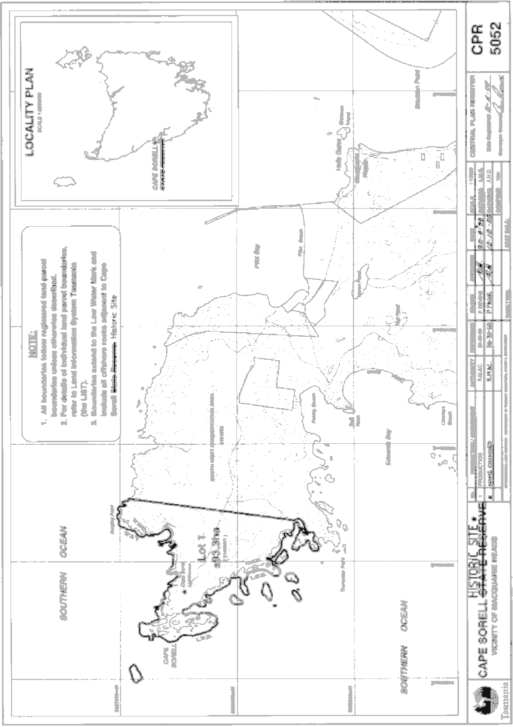
PART 2 - Cape Sorell Historic SiteAll that area of land comprising about 93.3 hectares shown bounded by a heavy black line on Plan Number 5052 in the Central Plan Register a reduced copy of which is set out, by way of illustration only, in Part 2 of Schedule 2 to this proclamation.
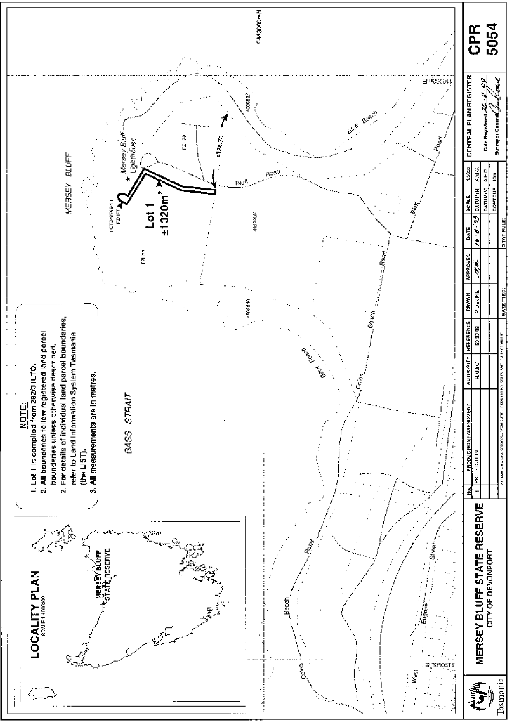
PART 3 - Mersey Bluff State ReserveAll that area of land comprising about 1 320 square metres shown bounded by a heavy black line on Plan Number 5054 in the Central Plan Register a reduced copy of which is set out, by way of illustration only, in Part 3 of Schedule 2 to this proclamation.
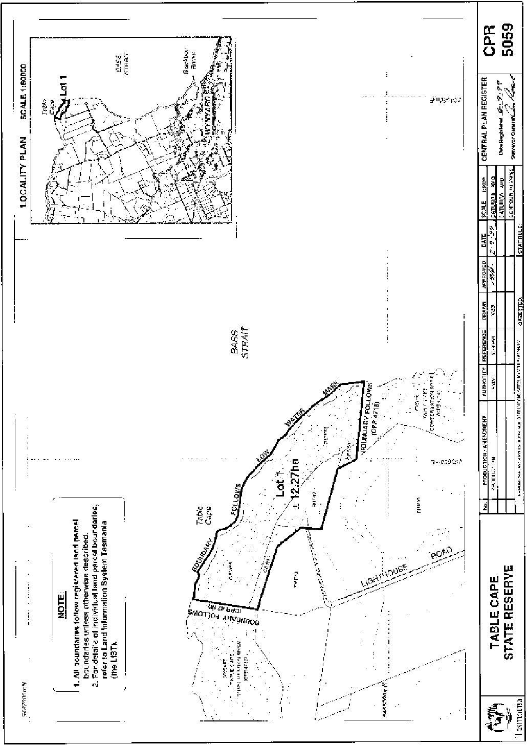
PART 4 - Table Cape State ReserveAll that area of land comprising about 12.27 hectares shown bounded by a heavy black line on Plan Number 5059 in the Central Plan Register a reduced copy of which is set out, by way of illustration only, in Part 4 of Schedule 2 to this proclamation.
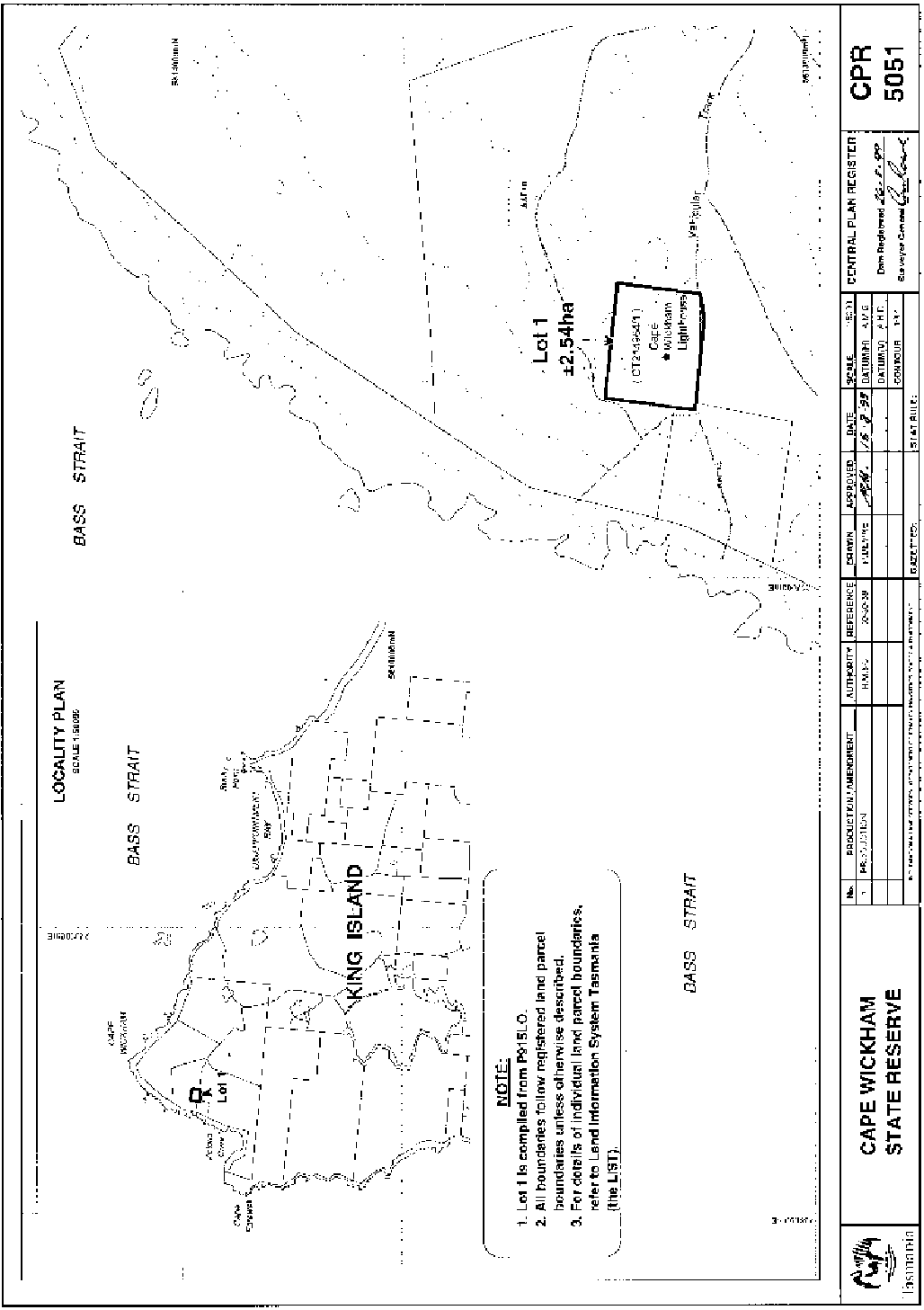
PART 5 - Cape Wickham State ReserveAll that area of land comprising about 2.54 hectares shown bounded by a heavy black line on Plan Number 5051 in the Central Plan Register a reduced copy of which is set out, by way of illustration only, in Part 5 of Schedule 2 to this proclamation.
SCHEDULE 2 - Plans
PART 1 - Low Head Historic Site
PART 2 - Cape Sorell Historic Site
PART 3 - Mersey Bluff State Reserve
PART 4 - Table Cape State Reserve
PART 5 - Cape Wickham State Reserve
Displayed and numbered in accordance with the Rules Publication Act 1953.
Notified in the Gazette on 13 December 2000
This proclamation is administered in the Department of Primary Industries, Water and Environment.
EXPLANATORY NOTE
(This note is not part of the proclamation)
This proclamation –(a) declares certain areas of Crown land to be reserved land in the class of historic site and gives names to those sites; and(b) declares certain areas of Crown land to be reserved land in the class of State reserve and gives names to those reserves.