

Proclamation under the Nature Conservation Act 2002
I, the Lieutenant-Governor in and over the State of Tasmania and its Dependencies in the Commonwealth of Australia, acting with the advice of the Executive Council, by this my proclamation made under section 12(1) of the Nature Conservation Act 2002 declare –
11 October 2004(a) the private land specified in Part 1 of Schedule 1 to this proclamation to be reserved land in the class of private nature reserve and give the name Burns Creek Private Nature Reserve to that reserved land; and(b) the private land specified in Part 2 of Schedule 1 to this proclamation to be reserved land in the class of private nature reserve and give the name Kings Run Private Nature Reserve to that reserved land; and(c) the private land specified in Part 3 of Schedule 1 to this proclamation to be reserved land in the class of private nature reserve and give the name Pegarah Private Nature Reserve to that reserved land; and(d) the private land specified in Part 4 of Schedule 1 to this proclamation to be reserved land in the class of private nature reserve and give the name Tatana Private Nature Reserve to that reserved land; and(e) that this proclamation takes effect on the day on which it is registered in accordance with section 22 of that Act.
W. J. E. COX
Lieutenant-Governor
By His Excellency's Command,
JUDY JACKSON
Minister for Environment and Planning
SCHEDULE 1 - Areas of Land
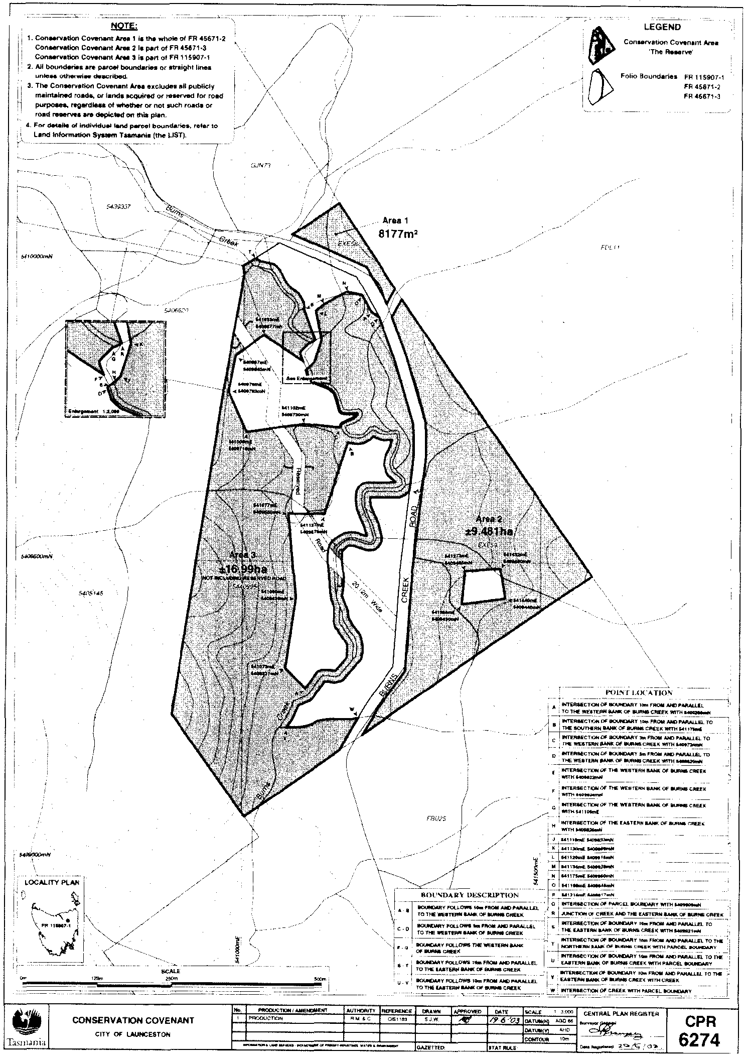
PART 1 - Burns Creek Private Nature ReserveAll those areas of land comprising –
shaded and bounded by heavy black lines on Plan 6274 in the Central Plan Register, a reduced copy of which is set out, by way of illustration only, in Part 1 of Schedule 2 .(a) about 8 177 square metres shown as Area 1; and(b) about 9.481 hectares shown as Area 2; and(c) about 16.99 hectares shown as Area 3 –
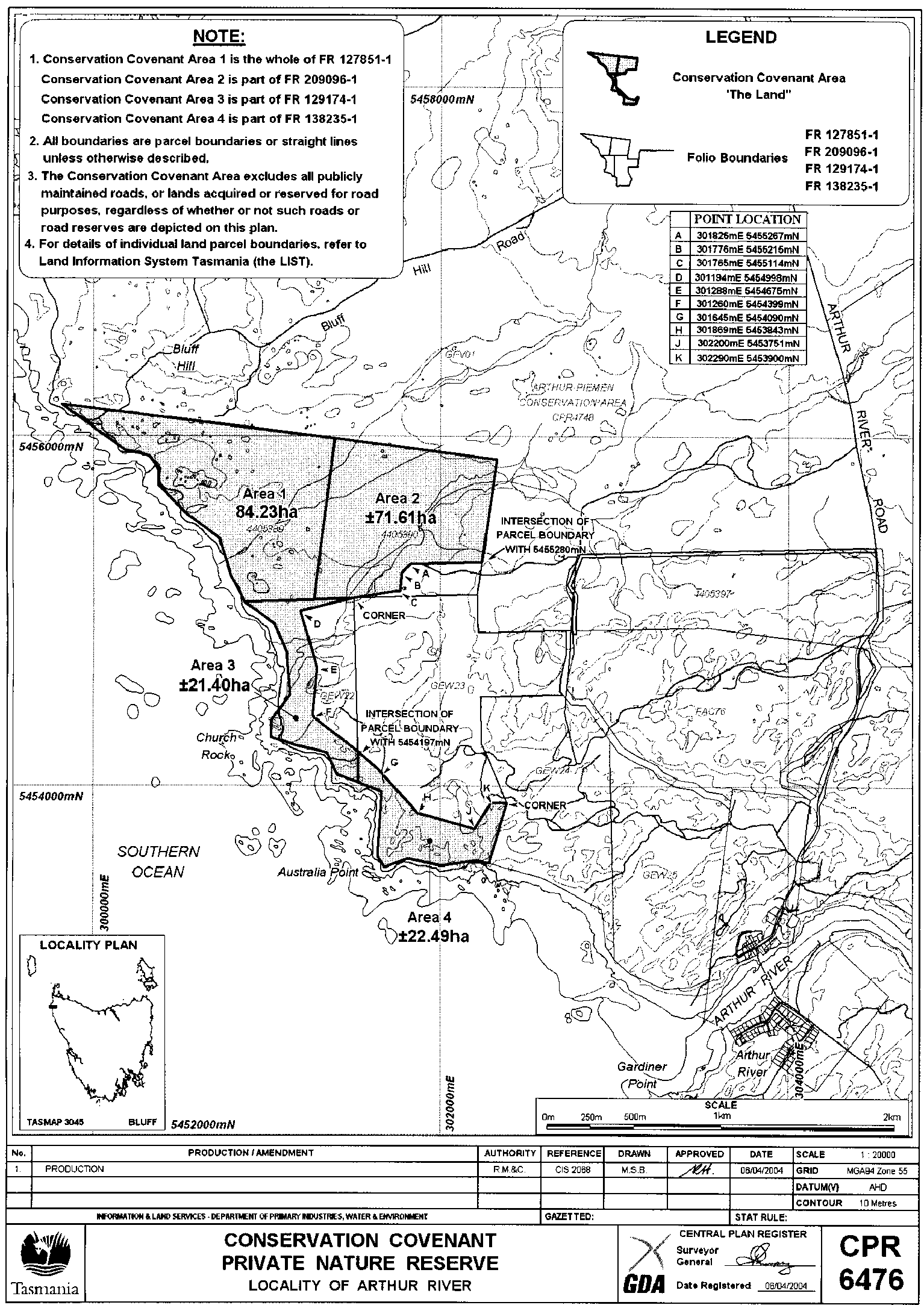
PART 2 - Kings Run Private Nature ReserveAll those areas of land comprising –
shaded and bounded by heavy black lines on Plan 6476 in the Central Plan Register, a reduced copy of which is set out, by way of illustration only, in Part 2 of Schedule 2 .(a) about 84.23 hectares shown as Area 1; and(b) about 71.61 hectares shown as Area 2; and(c) about 21.40 hectares shown as Area 3; and(d) about 22.49 hectares shown as Area 4 –
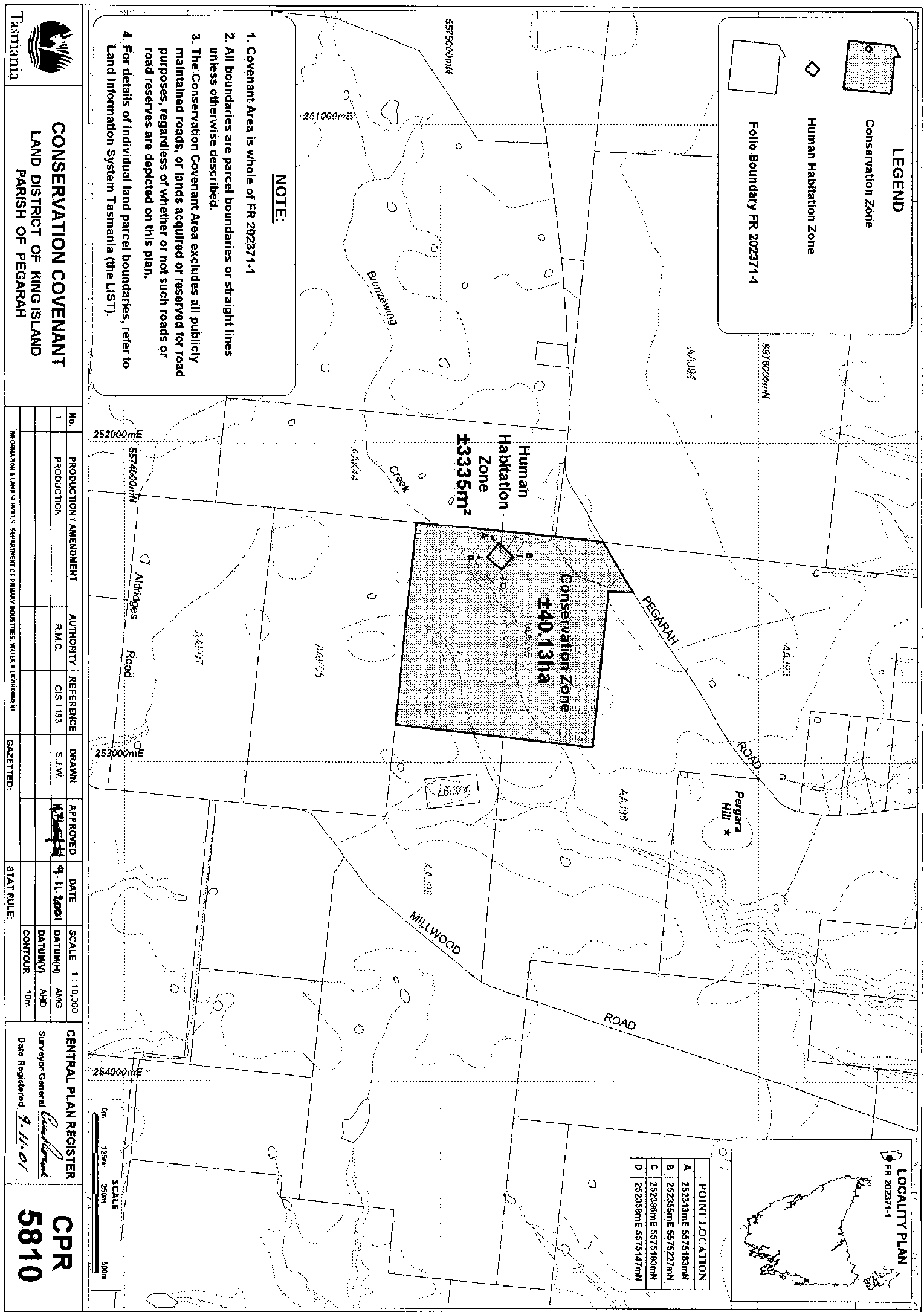
PART 3 - Pegarah Private Nature ReserveAll that area of land comprising about 40.13 hectares shown shaded and bounded by a heavy black line and labelled "Conservation Zone" on Plan 5810 in the Central Plan Register, a reduced copy of which is set out, by way of illustration only, in Part 3 of Schedule 2 .
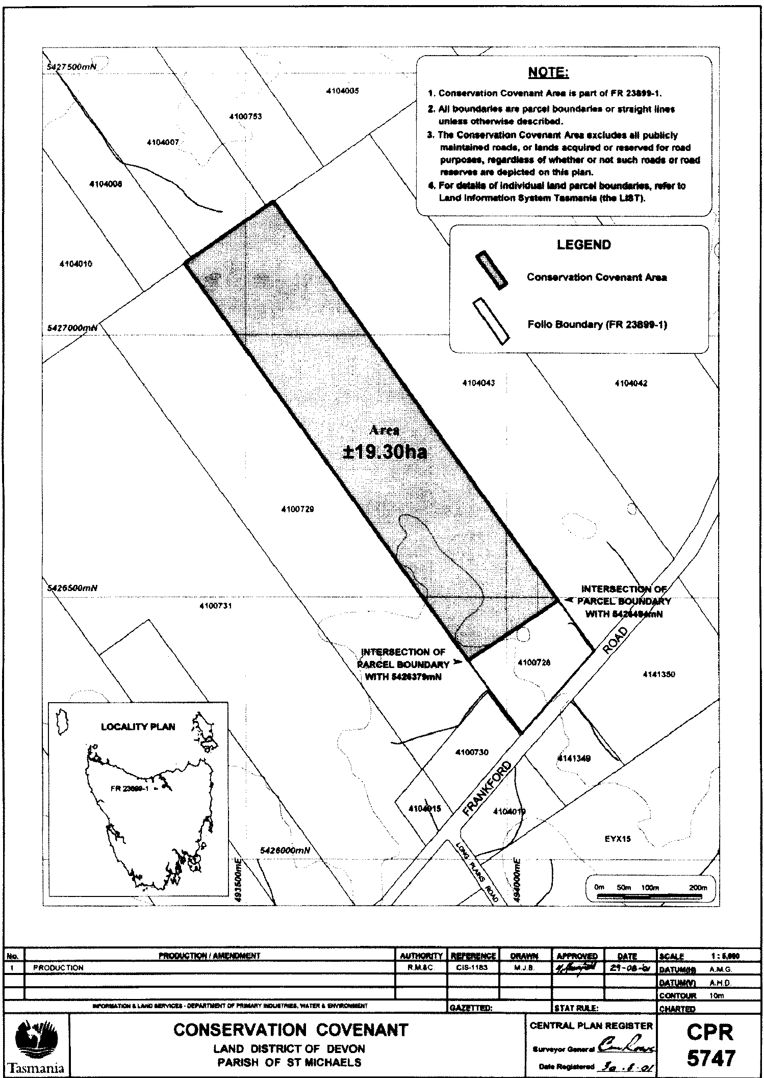
PART 4 - Tatana Private Nature ReserveAll that area of land comprising about 19.30 hectares shown shaded and bounded by a heavy black line on Plan 5747 in the Central Plan Register, a reduced copy of which is set out, by way of illustration only, in Part 4 of Schedule 2 .
SCHEDULE 2 - Plans
PART 1 - Burns Creek Private Nature Reserve
PART 2 - Kings Run Private Nature Reserve
PART 3 - Pegarah Private Nature Reserve
PART 4 - Tatana Private Nature Reserve
Displayed and numbered in accordance with the Rules Publication Act 1953.
Notified in the Gazette on 20 October 2004
This proclamation is administered in the Department of Primary Industries, Water and Environment.