Proclamation under the Roads and Jetties Act 1935
I, the Governor in and over the State of Tasmania and its Dependencies in the Commonwealth of Australia, acting with the advice of the Executive Council and with the consent of the Forestry corporation established under the Forestry Act 1920, by this my proclamation made under section 7 of the Roads and Jetties Act 1935 and in pursuance of section 27(2) of the Forestry Act 1920 –
19 March 2012(a) revoke the following proclamations made under the Roads and Jetties Act 1935 :(i) the proclamation notified in the Gazette on 30 December 2009 as Statutory Rules 2009, No. 195;(ii) the proclamation notified in the Gazette on 7 April 2010 as Statutory Rules 2010, No. 25;(iii) the proclamation notified in the Gazette on 28 July 2010 as Statutory Rules 2010, No. 72;(iv) the proclamation notified in the Gazette on 29 June 2011 as Statutory Rules 2011, No. 55; and(b) declare the portions of road specified in Schedule 1 to this proclamation to be subsidiary roads for the purposes of Part II of the Roads and Jetties Act 1935 and classified as tourist roads; and(c) declare that this proclamation takes effect on 2 April 2012.
PETER G. UNDERWOOD
Governor
By His Excellency's Command,
D. J. O'BYRNE
Minister for Infrastructure
SCHEDULE 1 - Portions of Road
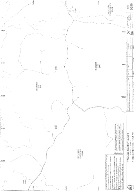
1. The portion of road shown by a heavy black broken line extending from E: 311389 N: 5438024 to E: 316636 N: 5436956 on Annexure Sheet 1 of Plan 9255 in the Central Plan Register (a reduced copy of which sheet is set out, by way of illustration only, in Part 1 of Schedule 2 ).
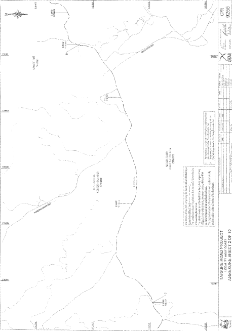
2. The portion of road shown by a heavy black broken line extending from E: 321187 N: 5438255 to E: 321761 N: 5438453 on Annexure Sheet 2 of Plan 9255 in the Central Plan Register (a reduced copy of which sheet is set out, by way of illustration only, in Part 2 of Schedule 2 ).
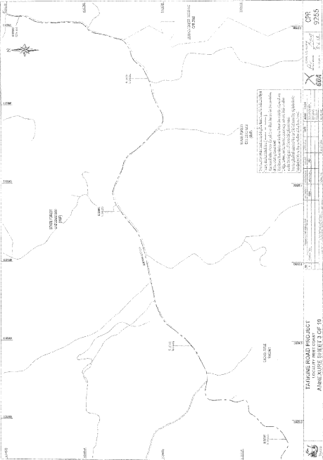
3. The portion of road shown by a heavy black broken line extending from E: 321761 N: 5438453 to E: 327133 N: 5441840 on Annexure Sheet 3 of Plan 9255 in the Central Plan Register (a reduced copy of which sheet is set out, by way of illustration only, in Part 3 of Schedule 2 ).
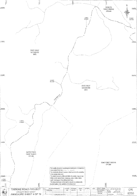
4. The portion of road shown by a heavy black broken line extending from E: 327133 N: 5441840 to E: 330769 N: 5446446 on Annexure Sheet 4 of Plan 9255 in the Central Plan Register (a reduced copy of which sheet is set out, by way of illustration only, in Part 4 of Schedule 2 ).
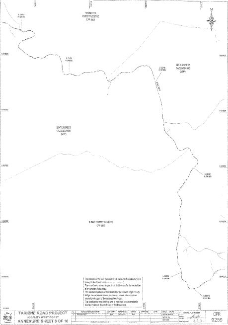
5. The portion of road shown by a heavy black broken line extending from E: 330769 N: 5446446 to E: 333875 N: 5441804 on Annexure Sheet 5 of Plan 9255 in the Central Plan Register (a reduced copy of which sheet is set out, by way of illustration only, in Part 5 of Schedule 2 ).
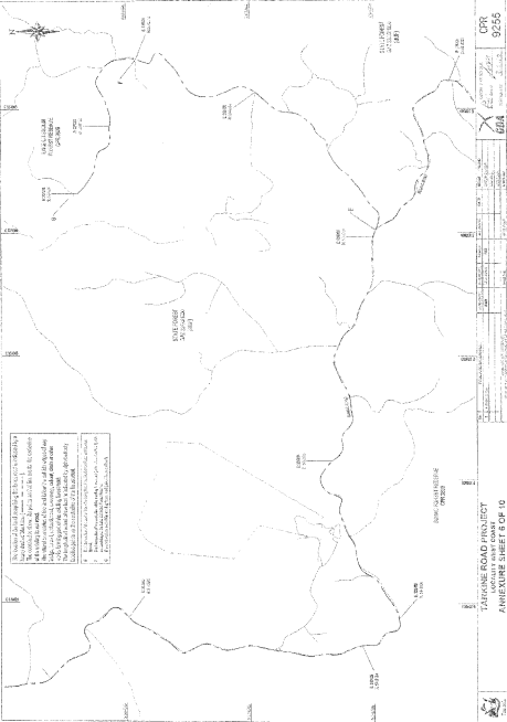
6. The portion of road shown by a heavy black broken line extending from E: 333875 N: 5441804 to E: 337318 N: 5444394 on Annexure Sheet 6 of Plan 9255 in the Central Plan Register (a reduced copy of which sheet is set out, by way of illustration only, in Part 6 of Schedule 2 ).
7. The portion of road shown by a heavy black broken line extending from E: 336968 N: 5442009 to E: 338225 N: 5441382 on Annexure Sheet 6 of Plan 9255 in the Central Plan Register (a reduced copy of which sheet is set out, by way of illustration only, in Part 6 of Schedule 2 ).
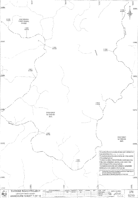
8. The portion of road shown by a heavy black broken line extending from E: 338225 N: 5441382 to E: 340706 N: 5444693 on Annexure Sheet 7 of Plan 9255 in the Central Plan Register (a reduced copy of which sheet is set out, by way of illustration only, in Part 7 of Schedule 2 ).
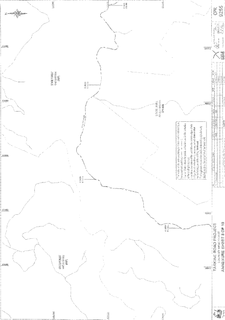
9. The portion of road shown by a heavy black broken line extending from E: 340706 N: 5444693 to E: 344763 N: 5445996 on Annexure Sheet 8 of Plan 9255 in the Central Plan Register (a reduced copy of which sheet is set out, by way of illustration only, in Part 8 of Schedule 2 ).
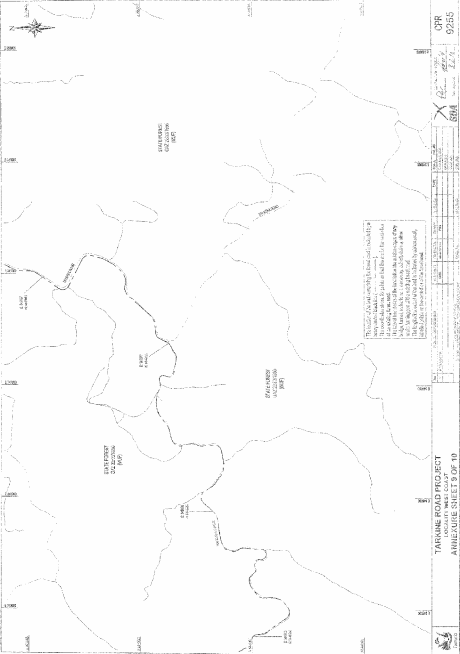
10. The portion of road shown by a heavy black broken line extending from E: 344763 N: 5445996 to E: 347967 N: 5447881 on Annexure Sheet 9 of Plan 9255 in the Central Plan Register (a reduced copy of which sheet is set out, by way of illustration only, in Part 9 of Schedule 2 ).
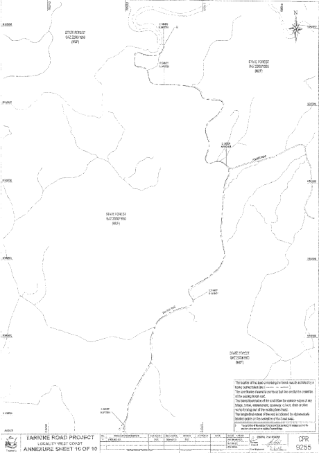
11. The portion of road shown by a heavy black broken line extending from E: 347967 N: 5447881 to E: 348499 N: 5452755 on Annexure Sheet 10 of Plan 9255 in the Central Plan Register (a reduced copy of which sheet is set out, by way of illustration only, in Part 10 of Schedule 2 ).
SCHEDULE 2 - Plans
PART 1 - Annexure 1 of 10
PART 2 - Annexure 2 of 10
PART 3 - Annexure 3 of 10
PART 4 - Annexure 4 of 10
PART 5 - Annexure 5 of 10
PART 6 - Annexure 6 of 10
PART 7 - Annexure 7 of 10
PART 8 - Annexure 8 of 10
PART 9 - Annexure 9 of 10
PART 10 - Annexure 10 of 10
Displayed and numbered in accordance with the Rules Publication Act 1953.
Notified in the Gazette on 28 March 2012
This proclamation is administered in the Department of Infrastructure, Energy and Resources.
